


Moderate rainfall has reduced hazard risks over the past 24 hours, though authorities have urged at-risk communities to continue monitoring conditions as they evolve across the summer.
RFS Superintendent Ben Shepherd forecast some “reprieve” on Monday, but signalled more danger for Tuesday and into the weekend.
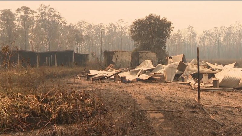
Premier Chris Minns visits areas affected by the Koolewong bushfire on Sunday.Credit: Sitthixay Ditthavong
“Wednesday it’ll start to drop back down again, but towards the weekend, it’s starting to show signs of some high fire danger,” Shepherd told 2GB.
“We need some really good rain to soak in, take the sting out of the fires that are there … we could continue to have these waves of high fire risk, and we just need everyone to be aware of that.”
Minns said the bushfires in Koolewong could represent “pretty dark harbingers” for the summer period, after a historically wet August prevented firefighters from conducting hazard reduction burns in winter.
Loading
“We’re going to need people to follow advice, listen to emergency services, download the Hazards Near Me app so that they’ve got the latest up-to-date information,” Minns said.
“And if you’re asked to go and leave your home, I can promise you firefighters and police are not doing that because they’re trying to inconvenience you, they’re doing it to try to save your life.”
A natural disaster has been declared to activate assistance for communities on the Central Coast, the Mid-North Coast and Upper Hunter regions, as well as in Dubbo in the state’s west, allowing for a suite of measures to help residents, businesses, primary producers and councils.
Read the full article here


