


Mark Barton and others at Peregian Beach on the Sunshine Coast felt the quake about 85 kilometres away.
“We thought initially there might be some construction work gone wrong,” he said. “Then the vibrations got quite strong, and stronger.
“The windows were rattling and the whole house was shaking, not violently but quite noticeably.”
The vibrations went on for about a minute, bringing neighbours onto the street.
Loading
“It caused, not panic, but it caused people to be a bit scared,” Barton said.
Trains on all Brisbane lines were also affected, with lingering delays of up to 45 minutes expected after services ran at lower speeds in the quake’s immediate aftermath. Queensland Rail said initial assessments revealed no damage to tracks or rail infrastructure.
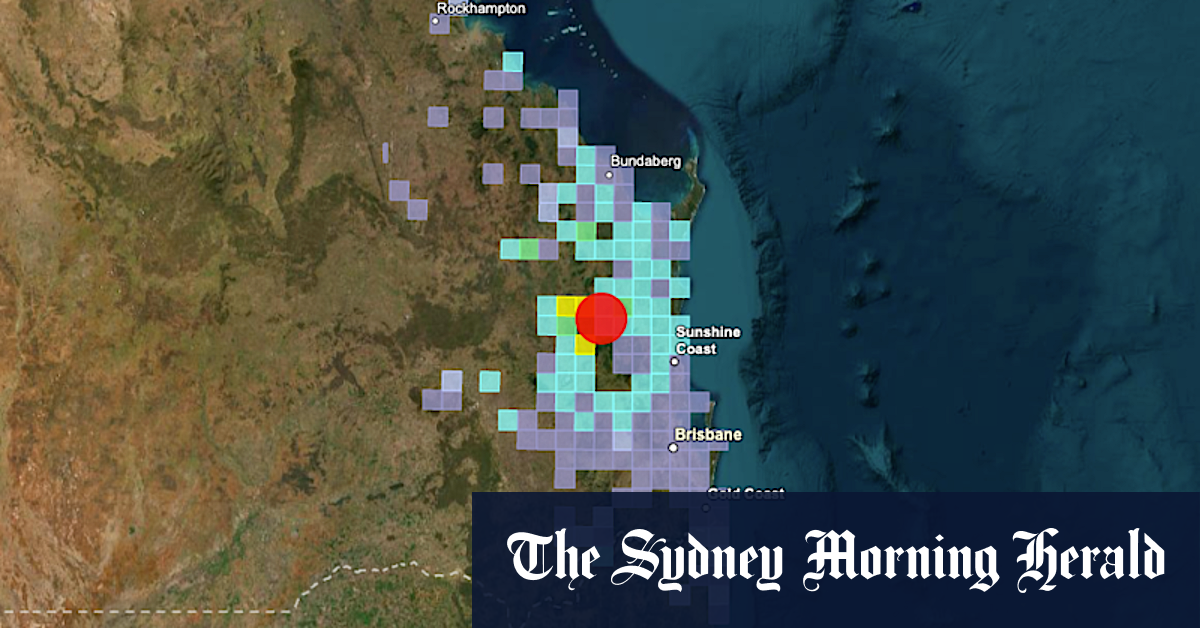
The quake would rank among the largest recorded in the state, behind the 6.0 “great Queensland quake” off the coast of Gladstone in 1918.
Gayndah, about 100 kilometres north-west of Saturday’s quake, also recorded a magnitude 6.1 tremor back in 1935, while a 5.8 magnitude earthquake struck off Bowen in the state’s north in 2018.
From the year seismographs started being installed around Queensland’s large dams in 1977 to 2000, more than 110 earthquakes were recorded on average each year.
A 2019 state earthquake risk assessment found the most quake-prone areas spanned a large region from Gladstone, south to the Scenic Rim, and out to the Western Downs.
Australia’s most devastating earthquake struck near the centre of Newcastle in 1989. While only a magnitude 5.6 tremor, it killed 13 people, injured 160, and damaged some 60,000 buildings.
The most intense quakes were a one-day series in 1988 near Tennant Creek, in the Northern Territory, that peaked at magnitude 6.6, according to a 2016 revision of major quakes by Geoscience Australia.
Read the full article here


