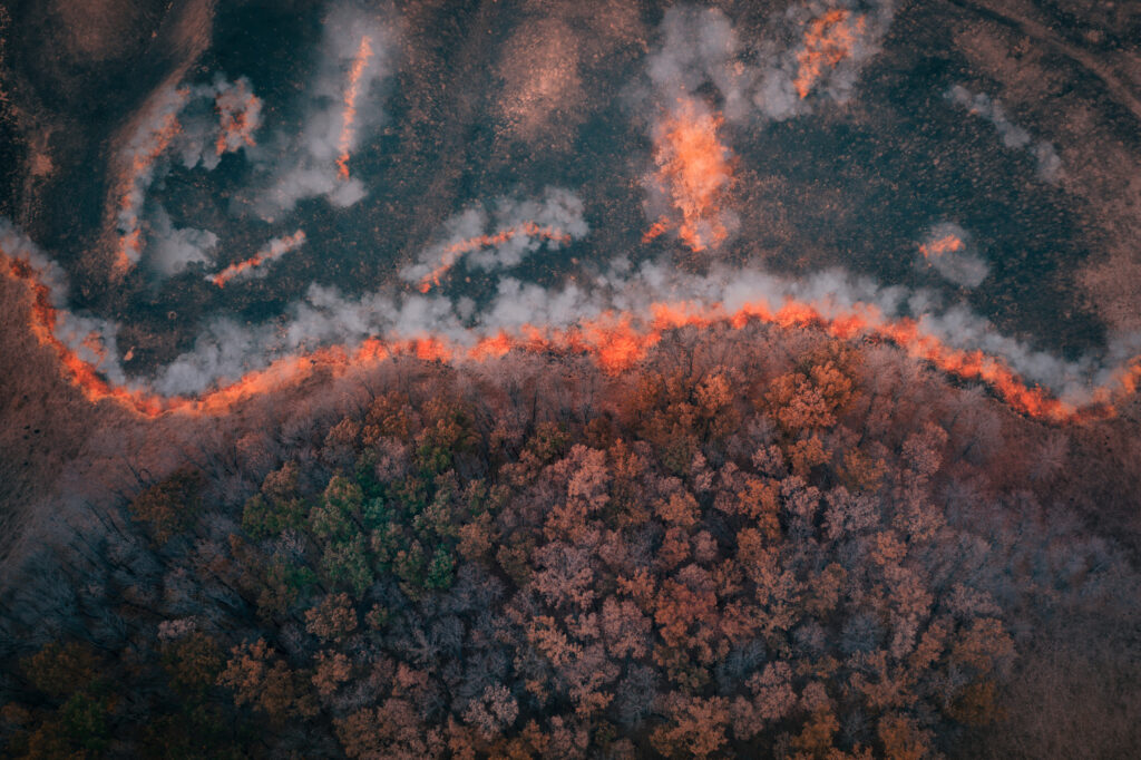
The National Weather Service (NWS) issued red flag warnings across three states Wednesday as forecasters say that a combination of dry fuels, gusty winds, low humidity and potential dry lightning are putting millions of acres at heightened wildfire risk.
The warnings, issued in Washington, Oregon and California, are effective throughout Wednesday afternoon and into the evening.
Why It Matters
The red flag warnings come during a period of prolonged drought and elevated temperatures in the Pacific Northwest, conditions that have resulted in wildfire risk across the region.
The issuance of multiple, overlapping fire weather advisories underscores the increased danger to human safety, property, air quality and infrastructure, especially in communities near undeveloped wildlands. Officials stressed that even a single spark could trigger a large, fast-moving fire.
What To Know
Meteorologists said Wednesday that an incoming weather system on the West Coast would bring scattered thunderstorms—some producing little rainfall but strong winds—as well as extremely low relative humidity and high temperatures. The warnings advise that new fires could start easily and spread dangerously fast through dry vegetation, with outdoor burning strongly discouraged and residents urged to stay informed of local emergency protocols.
The red flag warnings span rural, agricultural and forested areas, including the Kittitas Valley in Washington; multiple regions across northern, southern and eastern Oregon; and parts of Northern California.
The warnings are traditionally issued when conditions are conducive to uncontrollable fire activity, meaning any new burnings pose a substantial public safety hazard.
The NWS emphasized the need for vigilance, saying in a public alert that “a combination of strong winds, low relative humidity, and warm temperatures can contribute to extreme fire behavior.”
Washington: Central and Eastern Regions Face Extreme Risk
NWS offices in Spokane and Pendleton extended red flag warnings from 2 p.m. to 9 p.m. PDT across fire weather zones in the Okanogan Valley, Methow Valley, Foothills of Central Washington Cascades, Waterville Plateau, Western Columbia Basin, Lower Palouse and Kittitas Valley.
Expected wind speeds run from 15 mph to 25 mph, with gusts reaching up to 40 mph, while relative humidity was forecast to drop as low as 10 percent to 18 percent.
“Rapid fire spread is likely with any new fires,” the warning said.
Outdoor burning and other activities with ignition risks should be avoided.
Oregon and California: Lightning and Wind Compound Hazards
In both Oregon and Northern California, including Siskiyou and Modoc counties and the Klamath Basin, the NWS Medford, Oregon, office maintained red flag warnings for abundant lightning on dry fuels through the evening, with winds of up to 45 mph.
What People Are Saying
NWS meteorologist Marc Spilde told Newsweek: “June 1 is when our fire season begins. Then that goes through October. So as we get into this time of year, things dry out. So we have quite a few red flag warnings throughout the summer season.”
NWS office in Medford, in a red flag warning: “Given the long stretch of dry and hot conditions, lightning efficiency will be moderate for new fire starts. Any fires that develop will likely spread rapidly.”
What Happens Next
Red flag warnings remain in effect through Wednesday evening, with weather conditions being closely monitored by local agencies. Residents in affected areas have been advised to check local resources to track current restrictions and updates on potential wildfire activity.
Read the full article here


