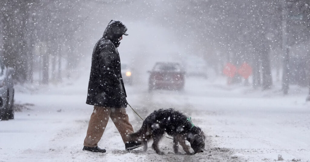
A major winter storm will finish carving a path from the central United States and the Midwest to the nation’s capital by Monday morning, after having punished multiple states with a mix of sleet, snow, blizzards and freezing rain.
Kansas was particularly hard hit. Most of the state was under winter storm and blizzard warnings on Sunday. In the Kansas City metropolitan area, residents hunkered indoors amid ice- and snow-covered driveways, and roads deemed too treacherous for travel.
Rapidly falling snow accumulated more than four inches in two hours on Sunday morning. Some areas experienced lightning and booming thunder along with wind gusts of up to 35 miles an hour as the storm moved across the region.
“This is a rare blizzard for Kansas City,” Gary Lezak, a longtime meteorologist in the area, said on Sunday. “It is insanely cold. This storm still has 12 hours to go as the blizzard intensifies.”
The storm caused numerous crashes over the weekend. West of Salina, Kan., a fire truck, multiple tractor-trailers, and passenger vehicles overturned. Several trucks went spiraling into ditches as icy roads became impassable.
On Sunday morning, Ben Gardner, a trooper with the Kansas Highway Patrol, shared on social media that he was at the I-135 and I-70 interchange in Saline County, where Kansas Department of Transportation crews and emergency responders were battling treacherous weather and road conditions.
“If you don’t need to travel, please stay home,” he urged.
The National Weather Service warned that up to 15 inches of snow (the highest accumulation in a decade) was expected from the storm, reducing visibility to dangerous levels and making travel “extremely hazardous.”
Mid-Atlantic braces for snowfall and freezing rain.
On Monday, the storm shifts to the Mid-Atlantic, where moderate to heavy snow is forecast to disrupt travel and daily routines. Pittsburgh was expected to see snowfall before both the morning and evening commutes.
The Weather Prediction Center’s winter storm severity won’t be as high as Sunday, yet moderate impacts, including hazardous driving conditions, are expected in portions of Delaware, Maryland, New Jersey, Virginia, West Virginia and southern Pennsylvania.
Several states in the path of the storm — including Arkansas, Kansas, Kentucky, Missouri, Virginia, West Virginia and parts of New Jersey — have declared states of emergency, and Maryland has declared a state of preparedness. The declarations are intended to improve the states’ responses to the storm through various means.
Baltimore and Washington, D.C., are both expected to get new snow accumulations of three to five inches on Monday.
Widespread light freezing rain will accompany the snow, extending from Kentucky to the Mid-Atlantic, creating treacherous conditions and the potential for power failures.
Early Monday, more than 60,000 customers were without power in Kentucky and 50,000 lost electricity in Indiana, according to PowerOutage.us, a tracking website.
Cold weather lingers.
By Tuesday morning, the snow is expected to taper off, although light snow may continue over parts of the Central Appalachians. Cold, gusty weather is forecast for the following days, with afternoon highs in the 30s in Washington, and overnight lows in the 20s.
“It’s going to be pretty cold for a good part of the week,” said Bob Oravec of the Weather Prediction Center. From the eastern Rockies to the East Coast, temperatures will be about 10 to 12 degrees below seasonal averages.
Yan Zhuang contributed reporting.
Read the full article here


