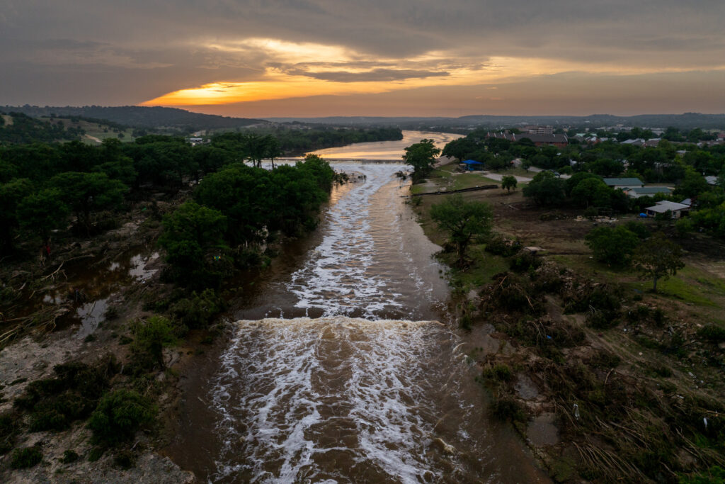
Relentless rains have been pounding Central Texas with life-threatening floods for more than a week. Meteorologists anticipate they will cease by midweek, but predict a new weather danger shifting into the region—posing renewed challenges for those battered by the floods.
Why It Matters
Flood-related weather alerts have been issued repeatedly across Central Texas since before July Fourth, as deadly floods swept the Texas Hill Country over Independence Day weekend. More than 100 people were killed, including 27 young campers and counselors at Camp Mystic in Kerr County.
Flooding is the second-deadliest weather hazard in the U.S. behind extreme heat. The rounds of heavy rainfall are shifting west later this week, AccuWeather meteorologists said, adding that higher temperatures are expected to move into the region—creating dangerous conditions for Texans and volunteers trying to help the state recover.
What To Know
As of Monday afternoon, widespread flood-related weather alerts were still in place across Central Texas.
Once a river floods, it can take several days for the waters to recede. For example, the San Saba River neared major flood stage on Sunday afternoon, National Weather Service (NWS) meteorologist Mark Cunningham told Newsweek. On Monday afternoon, the river is still flooded.
“It will start falling below flood stage by early Wednesday morning,” Cunningham said.
More rain and thunderstorms are forecast for Texas Hill Country on Tuesday afternoon, but then the weather pattern looks to dry out. Although this is good news for the flood-ravaged state, the drier weather also is expected to accompany high temperatures.
For Wednesday to Sunday, AccuWeather meteorologists predict “dangerous heat,” which could pose hazards to those helping with flood cleanup efforts.
On Wednesday, temperatures in Austin and San Antonio “are expected to sail into the upper 90s for the first time this month,” the AccuWeather report said, with Texas Hill Country expecting temperatures in the low 90s.
Humidity will make the temperature feel hotter than it really is. The heat index, or the feels-like temperatures, will be near 100 degrees in Central Texas. Some areas could feel as hot as 110 in Eastern Texas.
The National Weather Service (NWS) HeatRisk map shows that most of Texas is expecting a minor to moderate risk of heat-related impacts from Wednesday through Friday. However, more severe heat impacts are expected on Saturday and Sunday, particularly for the southern parts of the state, where some pockets could see a major risk of heat-related impacts.
What People Are Saying
AccuWeather meteorologist Alex Duffus, in a report: “An area of high pressure that has been centered over the Gulf is forecast to slowly move westward this week. Doing so, the tropical moisture that has been streaming into central Texas will shift away from the region, bringing drier conditions to the center of the state.”
NWS HeatRisk map definition for major risk: “This level of heat affects anyone without effective cooling and/or adequate hydration. Impacts likely in some health systems, heat-sensitive industries and infrastructure.”
What Happens Next
Much of Texas will see a respite from the rain later this week. Unfortunately, rain could return by the end of the month, AccuWeather meteorologists said.
Read the full article here


