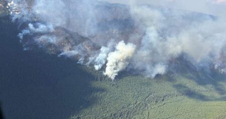




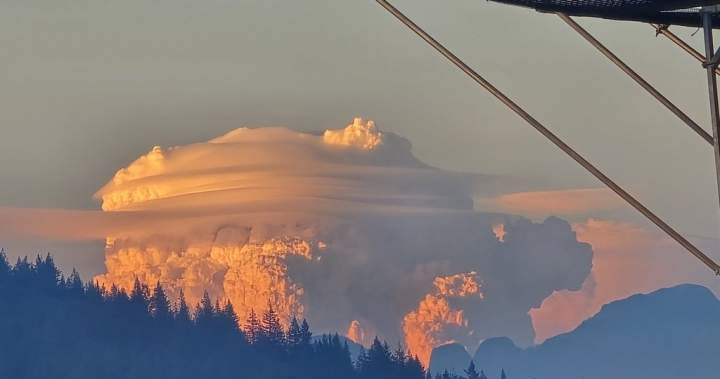
Photos of giant, cauliflower-like clouds are popping up on Vancouver-area social media feeds that experts say are pyrocumulus clouds produced by a wildfire more than 200 kilometres away.
BC Wildfire Service said the Anderson Creek fire was discovered by aircraft responding to one of the other nearby fires on Tuesday and it quickly flared up, fanned by strong winds.
Matt Loney, a meteorologist with Environment Canada, says each fire generates a lot of heat, and the Anderson Creek fire looks like it “really took off.”
Photos circulated across social media platforms on Tuesday show the tall cumulus clouds hovering over darker smoke plumes in the sky and they were taken as far away as Coquitlam, about 220 kilometres away.
Get daily National news
Get daily Canada news delivered to your inbox so you’ll never miss the day’s top stories.
Loney says anything hot enough to produce strong convection currents will give rise to the clouds, which are produced by hot air rising quickly as the moisture condenses.
He says an example would be opening your freezer door on a scorching hot summer day and the fog billows towards the ground.
“Basic science tells you that heat rises in the atmosphere, and cold air will sink,” Loney says.
“The heat wants to go up because that’s trying to seek stability because it’s less dense,” he says.
Loney says the clouds have all kinds of particulates in them, from burning embers and dust to ashes.
“All that is visible to the naked eye, and then once it gets to a level where it’s warm enough — so that it doesn’t rise any higher — it’ll just spread out into the horizontal,” said Loney.
The natural phenomenon from the Boston Bar-area fire indicates not only the intensity of heat, but also how unstable the atmosphere is, because the cloud grew vertically rather than horizontally, making it visible from many directions, says Loney.
Read the full article here