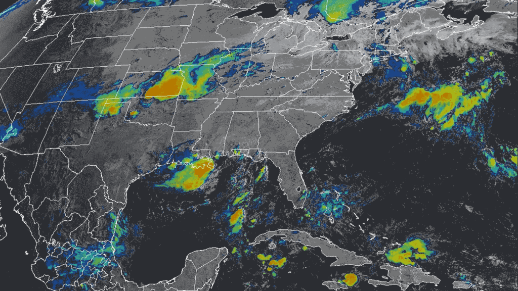
July has washed across the United States with unusually destructive, deadly torrents of rain.
In the first half of the month alone, historically heavy downpours sent rivers in Central Texas spilling far beyond their banks, causing at least 130 deaths. Rains prompted flash flooding across wildfire-scarred landscapes in New Mexico and flooded subway stations in New York City. Roadways in New Jersey turned into rivers, sweeping two people to their deaths as the floodwaters carried away their car. A tropical depression dumped up to 30 centimeters of rain in one day on parts of North Carolina, leading to at least six more deaths.
And heavy downpours continue to inundate Texas and the Midwest, even as a tropical rainstorm bears down on the Gulf Coast, threatening more flash floods in the region.
In the midst of the deluge, the U.S. Commerce Department this month indefinitely suspended work on the Atlas 15 project. The massive dataset, which was nearing completion, had aimed to update decades-old data on national rainfall in order to assess how climate change will affect the frequency and risks of extreme rainfall around the country.
Such storms are not just affecting the United States. Devastating floods have also slammed Mexico, Pakistan and Nigeria in recent weeks. And this supersoaked weather shows no signs of letting up.
To find out what’s behind this extreme rainfall, Science News talked with Joellen Russell, an oceanographer and climate modeler at the University of Arizona in Tucson. The interview has been edited for length and clarity.
SN: What’s the big picture here? What’s behind all the flooding?
Russell: It’s because of the warming atmosphere, and the warming ocean. We know that as the planet warms, the atmosphere holds more water vapor, about 6 percent more for every 1 degree Celsius increase in temperature.
Extreme rainfall is the driver of most floods. And extreme rainfall is on the rise. For example, there has been an increase of almost 60 percent in extreme precipitation in the northeastern United States.
[Editor’s note: The above trend in extreme precipitation data is for the period from 1958 to 2021. The data are from the U.S. Fifth National Climate Assessment, which was previously hosted at the government’s U.S. Global Change Research Program’s website. That site went dark in July, following the dismantling of the program, but the full report is currently still accessible at this NOAA repository.]
SN: How does that affect what we are seeing on the ground?
Russell: [The atmospheric] water vapor increase is what’s creating this vulnerability to flooding in many landscapes. It’s why we’re not just talking about Texas; we’re talking about New Mexico, we’re talking about North Carolina, all in the same week. And that’s not a weather thing. It’s a climate thing.
Storms last longer and are dumping more rain. Hurricane Harvey [which inundated Houston in 2017] just would not move on.
There are conditions on the ground that can make it easier or harder for there to be flash floods. The [Texas] Hill Country has steep, rocky slopes that make it particularly prone to flooding. When water moves over land, and over any rise in land elevation, the air rises and cools, and that can dump the water down. Like what happened in the Hill Country, or New Mexico.
But that’s not the main point. The main point is, if you have that many inches of water dropping onto any landscape in a short period of time, it’s going to flood. It won’t stay within boundaries, because too much water is being forced into channels that just were never built for that much water.
SN: How is the warming ocean contributing to flooding on land?
Russell: There’s a planetary imbalance, where about the same [amount of solar radiation] is coming in from the sun, but less is getting out than in the past. The blanket of carbon dioxide [in the atmosphere] has gotten so much thicker and has basically kept the heat from re-radiating back out to space.
But what most people don’t know is that the atmosphere only absorbs about 3 percent of that [heat]; 93 percent of it goes into the ocean.
And that is impacting communities affected by marine air flow — I’m looking at Texas, Louisiana, Alabama, Arkansas, Georgia, Florida. All of those states that are vulnerable to a very, very hot Gulf. It’s almost two degrees hotter [than normal], almost everywhere. All of those molecules are available for a passing breeze, to pick up that water and push it onto land and drop it. That warmer water is driving the bus here. And it’s not just warm right at the surface: it’s warm down 200, 300, 400 meters. So it’s a big deal, and it’s not going away.
SN: What about soil moisture? Can long-term drought, for example, affect the likelihood of flooding?
Russell: If we had normal precipitation, then the state of the soils could go either way. Some drought-ridden soils can act like concrete, where the water just runs right off. On the other hand, some soils, when they are drier, actually can absorb more.
But with that much rainfall, it’s going to flood no matter what the soil is. It isn’t really about the surface. It’s about the too much, too fast. There’s no good way to armor against a wilder, windier, warmer world when it’s raining everywhere, all at once.
SN: So how can people prepare for this new normal?
Russell: Everyone needs to sign up for local weather alerts — and do not silence the warnings. Not all phones can still get an SOS alert, so make sure yours is one that can and that you haven’t silenced it. Don’t just subscribe to commercial weather providers; also subscribe to the National Weather Service channels. The weather service does an excellent job of telling you ahead of time, but it’s important to make sure that you have access to alerts.
For homes or campsites, check your flood zone, know your flood risk and the best evacuation route. Have an emergency plan: Where would you go? Where would you take your kids and your pets? So if anyone gets separated, you have a plan. Prepare go bags, evacuation routes, communications plans. It’s super easy ahead of time and almost impossible afterwards.
SN: Do emergency officials have the tools they need to help communities weather these storms?
Russell: The Federal Emergency Management Agency makes flood maps, but it’s time to reassess those. Those maps are looking back at the past, and we need to be looking forward to the future. The whole idea of a “100-year flood” — it’s time to change those parameters, how we think about these things. Because in fact, they aren’t going to be 100-year floods anymore. And that shifting baseline is going to get us. This is also really straining our infrastructure: aging bridges, roads, they’re getting battered by bigger and more intense storms. And without adequate investment, we’re failing faster. We have to invest in our weather service and in our flood forecasting.
Read the full article here


